KuwaitAir
4


KuwaitAir puts current air quality data for locations across Kuwait into your pocket. The app collects readings from monitoring stations and calculates an Air Quality Index aligned with Kuwait’s environmental standards so residents and visitors can quickly assess health risks. You’ll see real-time pollutant measurements alongside meteorological context and interactive charts that reveal trends over days and weeks. People download KuwaitAir to plan outdoor activities, protect vulnerable household members, or simply stay informed about local conditions; its map-based interface and automatic updates make environmental information easy to understand at a glance.
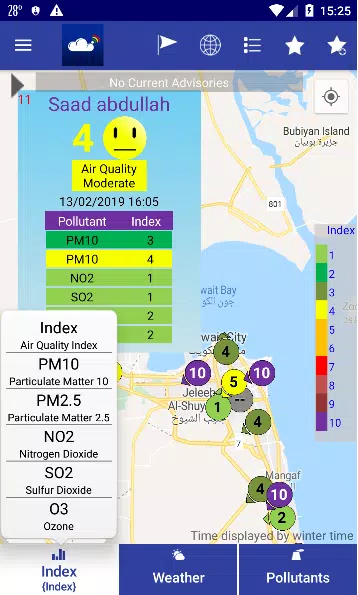
⭐ Real-time AQI readings across Kuwait calculated according to national environmental standards by KuwaitAir.
⭐ Interactive map that plots air quality monitoring sites for fast visual reference.
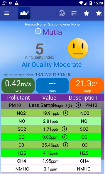
⭐ Pollutant measurement board listing particulate matter, ozone, nitrogen dioxide, and sulfur dioxide.
⭐ Automated updates from monitoring stations so data stays current without manual refresh.
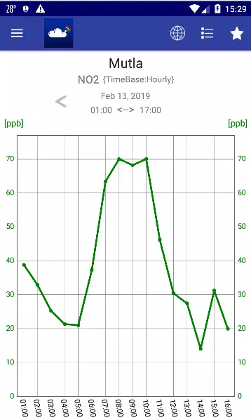
⭐ Historical charts that compare past measurements against AQI thresholds to highlight trends.
✅ Presents air quality using locally relevant AQI calculations for better decision-making.
✅ Combines pollutant data with meteorological readings to give a fuller environmental picture.
✅ Clear map and dashboard views make it simple to find cleaner areas or avoid polluted zones.
✅ KuwaitAir helps users monitor trends over time, supporting healthier planning of outdoor activities.
❎ Relies on the coverage and uptime of fixed monitoring stations, so remote locations may lack data.
❎ Information is focused on Kuwait and therefore not useful for users seeking air quality elsewhere.
❎ App data reflects measurements and trends but does not replace professional medical or environmental advice.